More Than a Race
To help you connect with your watershed, we are providing ideas for routes to explore within your region of the Fraser Watershed that highlight natural and cultural wonders.
Jump to routes in the:
Fraser Headwaters Region | Nechako Region | Cariboo-Chilcotin Region | Thompson Region | Fraser Canyon Region | Lower Fraser Region
Fraser Headwaters Region
Ancient Forest/Chun T’oh Whudujut Provincial Park
Highlights: universal access boardwalk, thousand-year-old Western Red Cedars
More

Boardwalk Through Ancient Forest by Gord Schindell.
The Ancient Forest/Chun T’oh Whudujut Provincial Park lies on Lheidli T’enneh traditional territory, in the northern reaches of the only Inland Temperate Rainforest in the world. A 450m long universal access boardwalk provides everyone with the opportunity to view thousand-year-old western redcedars and a rich biodiversity of plants, mosses, lichens, and fungi. A further 2.3 km of boardwalk passes by “Big Tree”, “Tree Beard”, “Radies Tree” and a cascading waterfall. With support of the Lheidli T’enneh First Nation, the park was protected in 2016 through a broad-based campaign led by a collaborative effort of the local Caledonia Ramblers Hiking Society, scientists at the University of Northern BC, and local environmental activists with the Dome Creek Forest Information Committee.
The Lheidli T’enneh First Nation announced last July that both the provincial and federal government are contributing funds toward an $8.7 million development project in the park. The nation plans to build new hiking trails, a sweat lodge, a pit house, a gazebo, and an interpretive center.
The park can be accessed off Highway 16 in the Upper Fraser, near McBride.
Barkerville to Groundhog Lake and Bald Mountain
Highlights: long distance hike, scenic views, historic significance
More
Barkerville, a National Historic Site, is the largest living-history museum in western North America, and lies at the end of the 700 km Cariboo Wagon Road built to connect Yale to the Cariboo gold fields during the 1860s gold rush.
From the top of the historic town’s main street, hikers can follow a 21 km return trail to Groundhog Lake and Bald Mountain while enjoying scenic views of the Bowron Lakes and the Rockies. Beginning on the Cariboo Mountain Road, the trail turns left at Summit Rock and follows an old goldfield ditchline through meadows to a deserted cabin. From there, a steep stretch up an old mining road leads to Groundhog Lake where hikers can enjoy views of Mount Agnes and stop for a picnic. Continuing on, the Lost Trail passes through meadows over the Mount Agnes Traverse. Follow an ATV Track to reach the summit of Bald Mountain. Hikers can choose to retrace their steps or take the Powderhouse Trail for a loop back to Summit Rock before retracing their steps to Barkerville.
Centennial Trail
Highlights: family friendly well-kept trails bordering the Nechako and Fraser rivers, options for full route or segmented trails.
More

Photo by Tessa Bokla.
The Centennial Trail is a 30 km trail that circumnavigates the “Bowl” area of Prince George. Kilometer zero is located at Lheidli T’enneh Memorial Park. The trail can be broken up into multiple segmented hikes, for example, folks could do Forest for the World one day, Moore’s Meadow another day, and then Cottonwood Island Park and the Lheidli T’enneh Memorial Park the next day!
The Centennial trail leads hikers through Cottonwood Island Nature Park. This park borders the Nechako River and features 20 faces carved into cottonwood trees by a Prince George local named Elmer Gunderson.
The Centennial Trail also encompasses Lheidli T’enneh Memorial Park, a park that features paved walkways along the Fraser River, sitting benches, picnic shelters, monuments, and a playground. The park is situated in what used to be the main village of Lheidli T’enneh people before the 20th century. All that remains of the village is a small First Nation Cemetery named the Lheidli T’enneh Burial Grounds.
You can start the Centennial Trail anywhere along its route, but the best places for parking is Lheidli T’enneh Memorial Park, Cottonwood Island Park or at the University of Northern BC.
Forests for the World
Highlights: options for both short and flat trails, as well as steep and long trails
More
Forests for the World Park offers a 15 km trail network on Cranbrook Hill within the city of Prince George. Visitors looking for a flat, short trail can walk to Shane Lake and enjoy a picnic area, canoe launch, and two fishing docks. For views of the city and the Rocky and Cariboo mountains, a steeper hike leads to the Lookout Viewing Platform. The Ridge Trail also climbs over the highest point in the city (880 m) and offers glimpses north to the slopes of the Nechako River.
Visitors are encouraged to look for the difference between some areas of the park that have been replanted with spruce, pine, and Douglas fir, and other areas that have been left in their natural state.
Along the Cranbrook Hill Greenway trail stands a traditional Dakelh-style pit house built by UNBC undergraduate and Lheidli T’enneh First Nation high school students. The pyramid-like wooden structure was built over a three-feet-deep pit and covered by the excavated clay and topsoil. Completed in 2014, the structure is now overgrown with plants, insulating the permanent winter dwelling.
The park can be accessed from a variety of other hiking trails, including the UNBC Greenway, Otway ski trails, and blue spruce trails. The Forests for the World parking lot is located on Kueng Road.
Fort George Canyon Provincial Park
Highlights: sandy beach with gravel and rocky outcrops along the Fraser River.
More
Fort George Canyon photo by AllTrails member Bttr-Rachel.
This 178-hectare park consists of two parcels on either side of the Fraser River south of the city of Prince George. Public recreation opportunities and trail access are available on the west side of the river.
The main trail is a 13.2-kilometre hike that has been rated as easy-moderate difficulty. Hikers recommend wearing hiking boots to avoid slipping on the protruding tree roots that act as stairs along the switch back sections on the way down to the river. Remember to be cautious by the Fraser River.
Hikers recommend avoiding using Google Maps to find this trail. To get to this hike, drive on West Lake Road for 9.7 kilometres and then turn left onto an unmarked road. Follow this road for 3 kilometres to a parking lot and voila, you made it!
Rearguard Falls Park
Highlights: waterfalls, end destination of chinook salmon after migrating from the ocean.
More

Rearguard Falls by Ralf Lotys (Sicherlich) – Wikipedia (Creative Commons 4.0).
The hike to the waterfalls is considered an easy there-and-back route. Hikers appreciate the lovely new pathway and viewing platform for looking at the falls.
The Rearguard Falls is the end destination after a long migration by Chinook salmon. The fittest chinook salmon make it above the falls, reaching the gravel spawning beds that they travel so far to find. Chinook salmon that do not make the leap over the falls successfully do not make it to their natal spawning grounds but still provide the ecosystem with plenty of nutrients through their carcass after they die.
This trail is located 285 kilometers east of Prince George on Highway 16. The trail is nearest to Tete Jaune Cache, Valemount and McBride.
Nechako Region
Canoeing Nak’alkoh (Stuart River)
Highlights: true backcountry experience, paddling among history
More
If adventure is what you’re after, Stuart River provides a compelling option for backcountry recreation.
The Dakelh name for Stuart River is Nak’alkoh, derived from the name of the peak (Nak’al) overlooking Stuart Lake (Nak’albun). To canoe Nak’alkoh is to take a trip through the history of the province. The river has long been an important travel route for both First Nations and early European settlers. Several important archaeological sites lie within Stuart River Provincial Park, the most notable of which is the village of Chinlac. Chinlac, located where Nak’alkoh meets the Nechako River, was once a large, thriving village. In 1745, it was destroyed by Tsilhqot’in raiders. It is now a provincially significant archaeological site and an important point of history for the region.
Near the mouth of the river lies Fort St. James, one of the oldest settler trading posts in the province, established by Simon Fraser in 1806. You can visit the Fort St. James National Historic Site to learn more about this area.
Experienced canoeists can tackle a 3 – 6 day trip down the Nak’alkoh, beginning at the mouth of the river near Fort St. James and ending near Prince George.
Fraser Mountain Hiking Trail
Highlights: multiple viewpoints, pine forests, 360° view of the Nechako Plateau and Fraser Lake.
More

Photo by AllTrails member Jason Laurie.
Fraser Mountain Hiking Trail is an 11 kilometre out-and-back trail that leads to an abandoned fire lookout on the top of Fraser Mountain. The viewpoint is a panoramic view of the Nechako Plateau/Fraser Lake. The trail takes hikers an average of 3 hours to complete. Elevation climb is 300 meters, which is mostly endeavored during the first few kilometers of the trail. Stay on trails and be careful of steep bluffs, holes and crevasses.
Greer Creek Trail
Highlights: 8-meter waterfall, swimming hole, family picnic spot.
More
The Greer Creek Trail is a well maintained 1.7 kilometer there-and-back path that leads to an 8-meter waterfall and picnic site! There is also a swimming hole at the falls where hikers can cool off before they start their trek back to the car. Hikers can follow a connector trail that leads to the top of the waterfall, or they can check out the plants and birds along Greer Creek. The trail is well maintained and is considered an easy trail. It takes hikers an average of one hour to complete.
Nechako Canyon Protected Area
Highlights: quiet 6.5km hiking trail, interesting geology features
More

Photo of Cheslatta Falls from the Province of BC’s Flickr account
A waterfall, towering pinnacles, caves, and overhanging cliffs are all features that can be seen within Nechako Canyon Protected Area. These features were carved from ancient lava flows by the once-raging Nechako River. The construction of the Kenney Dam in the 1950s diverted the Nechako River, leaving behind a dry riverbed that still contains ample evidence of the river’s power. The name “Nechako” comes from the Dakelh name netʃa koh, meaning “big river.”
The Nechako Canyon Trail is a 6.4km (one-way) hiking trail that ends with a viewpoint of Cheslatta falls and is suitable for most skill levels. There are also options to explore the canyon area by canoe and by raft.
Omineca Hiking Trail
Highlights: historic First Nation trading/transportation route.
More
The Omineca Hiking Trail is a 15 kilometre there-and-back trail that accommodates hiking, mountain biking and horseback riding. This hike explores meadows, lakes and rivers. The trail is rated as moderate and for certain sections tough. Hikers recommend wearing hiking boots to brave the muddy sections. There are parts of the trail that branch off into smaller paths, two of which lead to lakes!
Directions to trail: from Vanderhoof, drive 1.5 kilometres north on Burrard Ave, turn right on Northside Road. Continue for 5.4 kilometres to Striegler Rd on the right. The road has a large “Elephant Brand” business billboard. Take the dirt road for 4 kilometres and you will find parking on the left!
Waterlily Lake Trails
Highlights:multiple trail loops ranging from beginner to advanced, many ecosystems, lakes, scenic views
More
Only ten minutes from Vanderhoof, the 24 km Waterlily Lake Trail network offers seven loops ranging from 1.2 km to 12.6 km. These trails wander through various ecosystems including meadows, lakes, wetland swamps, rock bluffs, and lodge pole pine, spruce, and aspen forests. Hikers can camp at Waterlily Lake and Homestead Lake, both of which have three sided wooden shelters and open tenting areas. Logan’s Point, the site of the Moose Mountain Geodetic Survey, looks out over Blue Mountain and the Stuart Lake area. Pineridge Viewpoint also offers stunning views of the Nechako Valley. Keep an eye out for bears, moose, wolves, and coyotes! The trails are used for cross country skiing in the winter and are less maintained during the summer, so good footwear is encouraged.
Cariboo-Chilcotin Region
Churn Creek Protected Area
Highlights: Hiking, wildlife viewing, cycling.
More

Photo of Churn Creek by The Interior on Wikimedia – Creative Commons 4.0 license.
Churn Creek Protected Area includes some of BC’s rarest ecosystems – low, middle and high elevation bunchgrass habitats. This unique and fragile landscape provides habitat for a diversity of rare flora and fauna. These grasslands can be viewed and accessed by hiking on existing cow trails and old roads. However, the trails are unmarked and unmaintained, see map on the parks page for more information. Churn Creek Protected Area supports a ranch, so hikers can expect to encounter cattle. In Churn Creek Protected Area there is access to hiking, wildlife viewing, cycling, horseback riding and mountain biking.
Desous Mountain Trail
Highlights: Mountain biking from the top of Desous Mountain down to the Fraser River.
More
Desous Mountain Trail is a network of mountain biking trails on both sides of the mountain located 30 minutes from Williams Lake. The mountain bike trails on the back side (Fraser River) are geared towards intermediate-advanced riders, while the trails on the front side are lower level trails in mature forests. The highlight of the network of trails is the Shiney Badger Hidden Canyon Trail. The Shiney Badger Hidden Canyon Trail has a starting point of 3500 ft at the top of Desous Mountain and descends all the way down to the Fraser River! Find detailed trail information here.
Driving directions: from Williams Lake head west on Hwy 20, turn left onto Dog Creek Road and follow toward Springhouse. Just before Springhouse the road is on your right, follow this for 6 km to the trail head and camping area.
Dragon Mountain Provincial Park
Highlights: Range of mountain biking trails from beginner to black diamond
More
Eager to try mountain biking but not sure where to start? Dragon Mountain Provincial Park has a total of 13 trails ranging from beginner to black diamond! This park, made up of Douglas fir and lodgepole pine forests, offers sweeping views and some of the only slick rock mountain biking in the Cariboo. It is an important mule deer winter range and was established in 2013 as part of the Cariboo-Chilcotin Land Use Plan.
‘Walk in the Park’ is a perfect trail for families and new mountain bikers. Unlike some of the faster and more technical trails in the park which can only be accessed by driving or peddling up the access road, this machine-built, 1.6 km beginner trail offers a gradual climb to the top.
‘Rockin’ the Park’, a 5 km intermediate trail, can also be climbed gradually and will take riders to the top of the Dragon Mountain network. The trail starts off smooth and wide and slowly becomes tighter and more technical as it ascends. Riders can enjoy great vistas, tight climbing corners, switchbacks, and wooden ladder-bridges.
The provincial park can be accessed off Durrell Road, 14 km south of Quesnel.
Canim Lake & Mahood Falls
Highlights: Two stunning waterfalls, family-friendly trail.
More
The Canim Lake & Mahood Falls route is a family-friendly option that leads to exceptional viewpoints. The 2.3-kilometre trail is rated as an easy hike. The trail begins near Canim Lake (east of 100 Mile) and leads hikers along a ridge with views of the river valley and stunning geological features.
The first waterfall (Mahood Falls) is halfway along the extent of the trail. Mahood Lake feeds this stunning 15-meter waterfall. Hikers can continue along the trail to find Canim Falls, a 20-metre waterfall that is fed by an outlet of Manhood Lake.
Xatśūll Heritage Village
Highlights: Trails for hiking and mountain biking as well as guided cultural tours
More

Xatśūll Heritage Village by Jeremy Williams www.rivervoices.ca
The Xatśūll Heritage Village, alongside the Fraser River in the Northern Shuswap, offers guided cultural tours, activities such as beading, and accommodation. The Heritage Village will open on June 25 with COVID-19 measures in place. The nation has also been developing a network of high-quality trails suitable for mountain biking and hiking. All trail construction has been carried out by the Xatśūll First Nation trail crew and First Journey Trails including the Cross Country Trail that connects Xatśūll Heritage Village with Whispering Willows Campsite, one of the longest trails in the region.
Thompson Region
Battle Bluff
Highlights: magnificent view of Kamloops Lake, bluffs and desert landscapes.
More
Battle Bluff photo by Mary Putnam.
The Battle Bluff Trail is located within the Lac Du Bois Grasslands Protected Area in Kamloops. The trail is a well-maintained, medium difficulty, family friendly hike. The path is 4.8 kilometres and takes hikers an average of two hours round trip. The Battle Bluff Trail is surrounded by beautiful desert landscapes, leading to a magnificent view of Kamloops Lake.
Crater Lake Provincial Park
Highlights: lake views, geological features, waterfalls.
More
Crater Lake Falls by Mary Putnam.
Crater Lake Provincial Park offers fishing, hiking, and picnicking. Small series of waterfalls are also accessible to view. The Crater Lake Viewpoint Trail takes hikers on a 200-meter jaunt to a beautiful small lake called Crater Lake that resembles a volcanic lake, it is very deep and surrounded by basaltic rock formations. The lake is fed by a series of small, beautiful waterfalls. Hikers can expand their hike by following Purver Canyon Trail, a one-kilometer hike that passes through the park.
Dewdrop Trail
Highlights: panoramic view of Kamloops Lake and Thompson Valley.
More
Photo by Hike Kamloops (from Facebook).
Dewdrop Trail is a 12-kilometer trail that has multiple viewpoints throughout the hike, allowing hikers to make this trek as long or as short as they prefer. The trail leads to an incredible panoramic view of Kamloops Lake and Thompson Valley. Located 30 minutes from Kamloops.
Isobel Lake Low Mobility Trail
Highlights: Shade, universal access trail, interpretive signs, lake with fishing wharfs
More

Photo by Murray Foubister on Flickr
Looking for shade in the Thompson? Only a 40-minute drive from downtown Kamloops, Isobel Lake is a forested oasis surrounded by arid grasslands, and offers a universal access trail. The Low Mobility Trail (3.2 km round trip), marked by wheelchair signs, winds around the entire lake. Many interpretive signs and benches can be found along the wide path, as well as fishing wharfs where children and those with disabilities are encouraged to catch rainbow trout. There is also a large, covered picnic area with fire pits for cooking. From the parking lot, hikers can also trek up to Eagle Eye Lookout (1.3 km round trip) where an old tower offers views of the lake below. This area is home to a variety of wildlife including California bighorn sheep, moose, and sharp-tailed grouse.
North Fork Wild
Highlights: Family-friendly trail options among stands of old-growth inland rainforest
More
Looking for a walk that is nothing short of magical? Look no further than North Fork Wild.
In 2012, Peter Jennings donated 21 hectares of land to the Columbia Shuswap Regional District. Part of the rare interior rainforest ecosystem, this conservation park seems to have everything: views of a narrow gorge through which the Perry River flows, stands of old-growth forest, and a lush green understory rarely found in the Interior. It’s no wonder Peter called this property a “minor marvel.”
Globally, inland rainforests are extremely rare ecosystems. Of the temperate rainforests throughout the world, 98% are found in coastal areas. In BC, they total less than 5% of our landmass, but offer benefits in freshwater provision and carbon storage that far exceed the amount of space they occupy. Inland temperate rainforests are also the habitat of choice for endangered mountain caribou (though, for the sake of setting expectations, don’t expect to see those in North Fork Wild).
With trail offerings from 2km to more than 4km, this is a great family-friendly (although not stroller-friendly) outing. The Columbia Shuswap Regional District, in partnership with the Shuswap Trail Alliance (STA), have been instrumental in maintaining this trail system. The STA’s website contains more information about how to get to North Fork Wild and which trails to wander once you’re there.
Pavilion Lake
Highlights: Crystal clear lake suitable for swimming and diving
More
Photo of Pavillion Lake by SpacePhotoBill on Flickr https://www.flickr.com/photos/spacephotobill/3717522711/
Pavilion Lake can be found halfway between Lillooet and Cache Creek. It is a fantastic swimming lake, with beautiful clear water. At 5.8km long and 0.8km wide, it is great for family swims and also offers opportunities for long-distance swimmers.
Pavilion Lake is also home to one of the largest known groups of freshwater ‘microbialites’ – structures that resemble rocks or coral, formed by of many layers of cyanobacteria. It is estimated they started forming 11,000 years ago, and they are the subject of a research project led by both NASA and the University of British Columbia to try and understand how they might lead to greater understanding of the early formation of ecosystems – on Earth and other planets.
If you are a certified SCUBA diver who can dive at altitude (the lake 823m above sea level), you can check out these unique formations.
Fraser Canyon Region
Alexandra Bridge
Highlights: a great spot for picnicking, access to one of BC’s most beautiful and historic bridges
More

1958 photo of the Alexandra Bridge. Courtesy of Vancouver Public Library, photo by Donovan Clemson.
Alexandra Bridge is one of the most beautiful pieces of historic architecture in BC. Unfortunately, after being decommissioned in 1962 it was forgotten by many people in the province. The Spuzzum First Nation and New Pathways to Gold Society would like to change that.
Alexandra bridge, and the area it sits on, have a history spanning millennia. A naturally occurring narrow spot in the Fraser Canyon, this place has been used as a crossing point for First Nations since time out of mind. Alexandra Bridge itself was brought to life in 1862, used as part of the Cariboo Wagon Road leading to gold fields near Barkerville. As the railroad was built, this route saw less travel and the Alexandra Bridge fell into disrepair. It was ultimately destroyed by the great Fraser Flood of 1894.
Alexandra Bridge experienced its first moment of revival in 1926, when the bridge was rebuilt as part of an effort by the Province of British Columbia to build the Cariboo Highway – the first road meant for cars that connected the interior of the province to the coast. Travellers can still opt to take Highway 1 on their journeys inland, which will take them down this historic Cariboo Highway.
In 1962, the Trans-Canada Highway was completed, and it included a different bridge to cross the river and a route over the Coquihalla – once many people in the province will be familiar with. Once again, the Alexandra Bridge was decommissioned and fell into disrepair.
But Alexandra Bridge is experiencing its second renaissance. The Spuzzum First Nation, in collaboration with the New Pathways to Gold Society, is working to restore the bridge and create a safe crossing for visitors.
Visitors keen to check out this little-known spot packed with history can visit Alexandra Bridge Provincial Park. From there, it is possible to follow a 750m path to get to the bridge itself.
For those looking for a more challenging hike in a similar area, try the Tikwalus Heritage Trail, profiled below.
Falls Lake Trail
Highlights: hiking, fishing, rustic camping.
More
Photo by Sticker Mule on Unsplash.
Within Coquihalla Summit Recreation Area, lies a trail called the Falls Lake Trail. The hike is a 1.5-kilometer easy hike that follows a creek to Falls Lake. The creek can be heard along the entire walk through the subalpine forest path. The trail takes hikers an hour to complete on average with an elevation gain of 52 meters. Anglers can fish for rainbow trout in Falls Lake. There is a small rustic campground at Falls Lake (no facilities provided).
Red Rock Trail
More
Towering 500 m above Lillooet, an outcrop of crimson-coloured rock offers panoramic views of the town below, the surrounding mountains, and the striking confluence of Cayoosh Creek’s blue waters and the brown water of the Fraser River. The red rock is Mariposite, a nickel silicate that receives its colour from oxidized iron. Long before the Fraser carved its path through the valley, a swath of Mariposite ran from Red Rock across to Fountain Ridge opposite Lillooet. In the early 20th century, Lillooet celebrated July 1st with a grueling running race up the mountainside to Red Rock and back down to the town.
The moderate 3.4 km Red Rock Trail from Lillooet takes hikers up to the viewpoint. The trail can be accessed from the end of a cul-de-sac on Victoria St where a gravel road leads to a water tower. From there, the path turns into packed dirt with some steep stretches with loose rocks. Hikers will pass over dry hillsides dotted with Ponderosa pine up into stands of Douglas fir. Hiking boots and poles are recommended, and the trail should also be avoided in the afternoon heat due to sparse shade. Keep an eye out for Lewis’ woodpecker, an endangered species that has been previously spotted near the trail!
South Chilcotin Mountains Park
Highlights: hiking trails, horseback riding, mountain biking, swimming, fishing.
More
Hiking above Spruce Lake photo from BC Parks website.
The South Chilcotin Mountains Park offers 170 kilometers of hiking trails. Common activities include hiking, swimming in lakes along trails, horseback riding, fishing in Spruce Lake and mountain biking. Many of the trails lead to subalpine and alpine meadows, broad valleys, ridge walks and alpine lakes. The hikes in this park range from moderate to hard difficulty. The Gun Meadows Trail is an option that ascends Gun Creek along the journey to Spruce Lake for 3 kilometers and then connects to the Spruce Lake Trail at a junction on the south side of Spruce Lake. Along the trail, hikers can view open meadows and views of the valley. There is a campsite and a floatplane dock on the north end of Spruce Lake. Guided trips can be found here.
Tikwalus Heritage Trail
Highlights: 12km round trip steep hiking trail, interpretive signage along the route
More

Tikwalus Heritage Trail hike by iwona_kellie on Flickr https://www.flickr.com/photos/iwona_kellie/49911529136
The Tikwalus Heritage Trail has been in use since time immemorial by the Nlaka’pamux. A safe way to bypass the steep cliffs of Hell’s Gate Canyon, it was a heavily used travel route. The trail contains many points of interest, such as culturally modified cedars, enhanced by interpretive signage along the way.
The trail was restored in 2012 by the Hope Mountain Centre, in collaboration with Spuzzum First Nation, New Pathways to Gold Society, the Ministry of Transport, and Recreation Sites & Trails BC. In addition to interpretive signage, you can now find a campsite along the trail equipped with a picnic table, outhouse, and bear cache. Pictures of the restoration work can be found here.
Yak Peak
Highlights: hike to Yak Peak for a rewarding panoramic view of surrounding mountain peaks.
More

Yak Peak summit photo by Emily Masse, OutdoorVancouver.ca
Yak Peak is a steep granite peak located in Coquihalla Summit Recreation Area, near Hope, BC. The hike to Yak Peak is a 6 kilometer there-and-back trail with an elevation gain of 768 meters. The peak boasts a panoramic view of Needle peak, Vicuna and Guanco peaks. Hikers recommend allowing 6.5 hours to complete this trek. Near the beginning of the hike, steep sections in forest landscapes occur, leading to some rock hopping below the peak while traversing. There is one rope along the hike to assist hikers up a steep section with loose gravel. Hikers recommend wearing good hiking boots and brining poles to assist on the way back down. Hikers are cautioned to be on the lookout for loose rocks rolling down steep sections. There is some amount of snow present along the path all year.
Lower Fraser Region
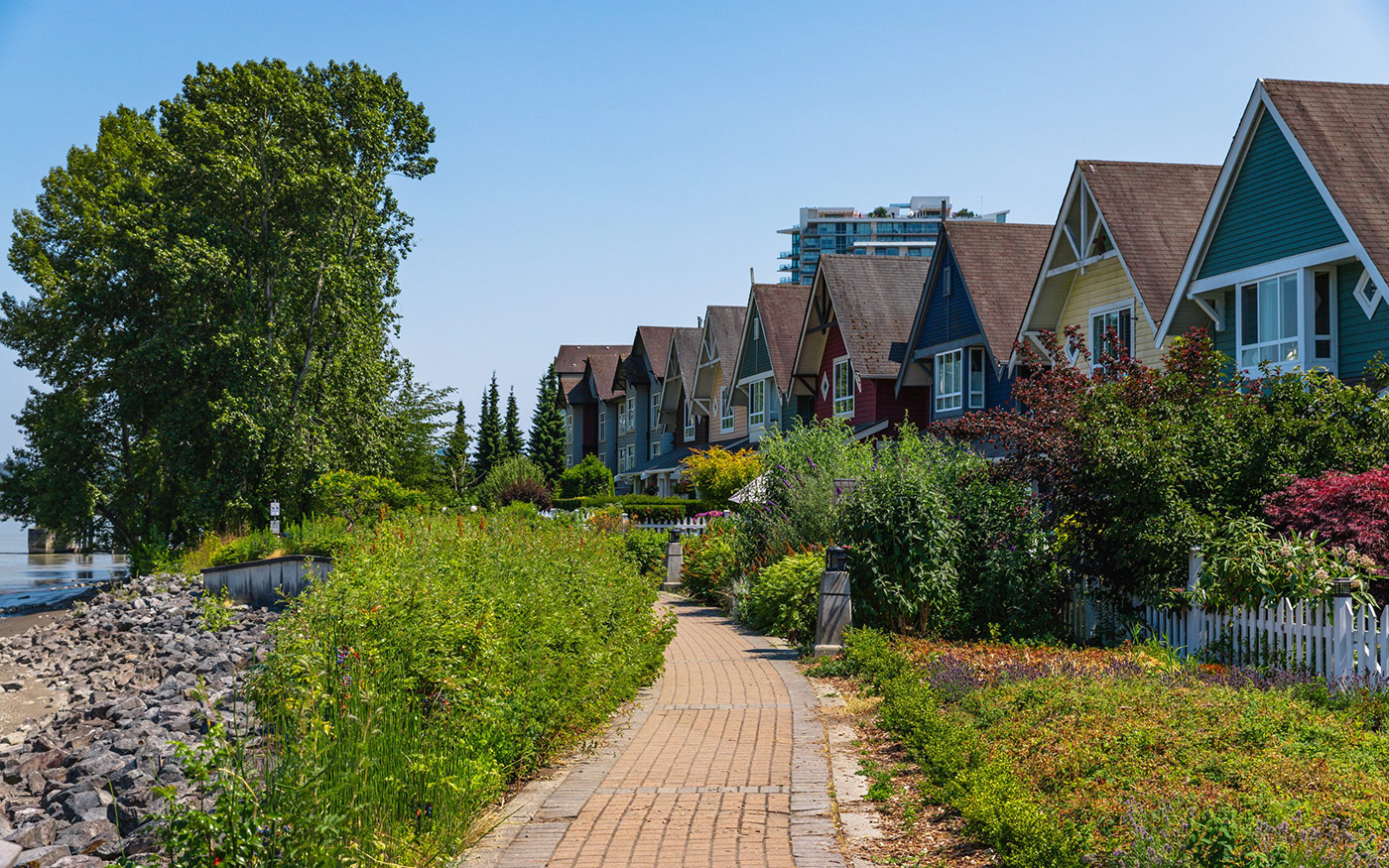
Biking in the Heart of the Fraser
Highlights: 18km flat trail perfect for cycling with views of the Fraser River, farmland, and Cascade Mountains
More
The Canyon to Coast Trail plans to connect Hope to the Salish Sea along 550 km of the Lower Fraser River Corridor. In 2017, an 18 km section of this trail opened in Chilliwack between Island 22 Regional Park and Ferry Island Provincial Park. Running mostly along existing dykes, the trail is perfect for cycling and offers spectacular views of the river, farmland, and the Cascade Mountain range. It is also a convenient 5 km from Chilliwack’s historic downtown.
Chilliwack, on Stó:lō territory, lies in the middle of the “Heart of the Fraser”. This 80 km stretch between Mission and Hope is one of the most productive river channels in the world. Unique islands within the river are surrounded by gravel bars which provide critical spawning and rearing habitat for many fish species, including the prehistoric white sturgeon and the endangered Chinook salmon. These fish lay their eggs beneath the gravel, and the calm waters covering the gravel bars act as nurseries for juvenile fish once they have hatched.
Recently, conservationists and biologists have been concerned by off-roading activities on Gill Bar, a gravel bar near Chilliwack that can be seen from the Canyon to Coast Trail. ATVs and off-road trucks have been driving across the gravel bar, not only crushing fish eggs, but also causing plumes of mud and silt to cloud the water, depriving the eggs and juvenile fish of oxygen. Unfortunately, the eggs and juvenile fish cannot be seen with the naked eye, and locals are calling for more education, signage, and the area to be closed to off-road vehicles. Other impacts to this fragile ecosystem include logging and agricultural development on the small river islands.
Deas Island Regional Park
Highlights: walking, birding or biking along trail, accessible picnic tables.
More

Deas Island Marsh at dusk by Sam Nixon.
Deas Island Regional Park is located on an island in the lower reaches of the Fraser River, this is a great place for a picnic, a quiet walk or a paddle along the Deas slough. The trail is a 4.7-kilometer loop that is suitable for walking, biking, trail running or birding. The Inverholme Schoolhouse, Heritage Area toilets and picnic table, and Fisher’s Field picnic shelter tables are all wheelchair accessible. There is also a paved path to a viewpoint at the Heritage Picnic Area. Tinmaker’s Walk is a 3-meter-wide trail, with a coarse gravel base, with minimum grade changes. The trail may be accessible for some users from the Fisher’s Field to the Heritage area parking. The park derives its name from John Sullivan Deas, who established a salmon cannery on the site in 1873. Read more about him through the BC Black History Awareness Society website.
Fort to Fort Trail
Highlights: Family-friendly activity options including cycling, paddling, and swimming
More
Around 50 km from the mouth of the Fraser River, Langley boasts scenic biking and walking trails, accessible paddling and swimming spots in the Fraser, and a national historic site.
If you’re looking for a family-friendly biking and walking trail in the Lower Mainland, look no further! The Fort to Fort Trail parallels the Fraser River and Brae Island, and connects the Fort Langley National Historic Site with the original fort site. This 4 km gravel path leads into Derby Reach Regional Park, where you can enjoy views of Mount Baker and explore the original fort site. Built in 1827, Fort Langley was one of the first trading posts of the Hudson’s Bay Company and was proclaimed “the birthplace of BC” in 1858. A cairn, house, and barn still stand at the original site.
For a longer ride or walk (12 km one way), start at the Golden Ears Bridge and follow the curve of the river along The Great Trail through farm fields and meadows. Once you enter Derby Reach Regional Park, follow the Edge Farm Trail and take in views of Kanaka Creek Regional Park and Golden Ears Provincial Park. This leads to the original fort site and connects with the Fort to Fort Trail where you can continue on to the National Historic Site. If you’d like to extend your ride or walk further, before you reach the National Historic Site, cross the bridge onto Brae Island. A 6 km loop through Brae Island Regional Park features tall cottonwood forests and scenic views of the Fraser.
Looking to get in or on the river? Sheltered between Langley and Brae Island, Bedford Channel is a safe waterway for canoeing, kayaking, paddle boarding, and swimming. Boats can be launched from public docks in Langley. On the island side, rent kayaks or swim from the sandy beaches in the regional park.
Langley is also popular for birding, so while you’re out for any of these activities, keep an eye out for birds like the Wood Duck and Cedar Waxwing. Happy exploring!
Gold Creek Falls-Maple Ridge
Highlights: views of waterfalls, well-kept hiking trail.
More
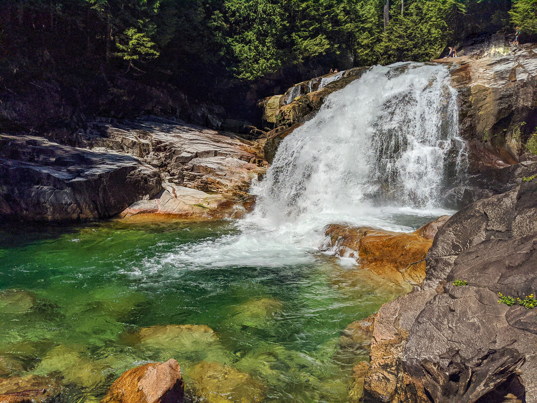
Gold Creek Falls from OutdoorVancouver.ca
The Lower Falls Trail is a popular hike in Golden Ears Provincial Park, near Maple Ridge, B.C. The Lower Falls Trail is a great hike for those camping in the park or visiting Alouette Lake. The trail is wide and groomed the entire way to the Gold Creek Falls. With minimal elevation gain, this is an easy hike, perfect for beginner hikers and children. The Lower Falls Trail is a 5.6-kilometer hike that winds through a beautiful stretch of forest before reaching the Gold Creek Falls waterfall. It takes about 1 hour each way.
Queensborough Perimeter Trail
Highlights: views of the Fraser River, wheelchair accessible, 7 kilometres of trails.
More
Wrapping around the tip of Lulu Island, the Queensborough Perimeter Trail and River Walk offer views of Downtown New Westminster, the Fraser River and Poplar Island. Over 7 km of trails featuring river vistas, lookout points, wheelchair accessibility, trees, flowers, benches and a dock.
Sendero Diez Vistas
Highlights: Steep 15 km hike, unique and spectacular views, swimming beaches, close to Vancouver
More
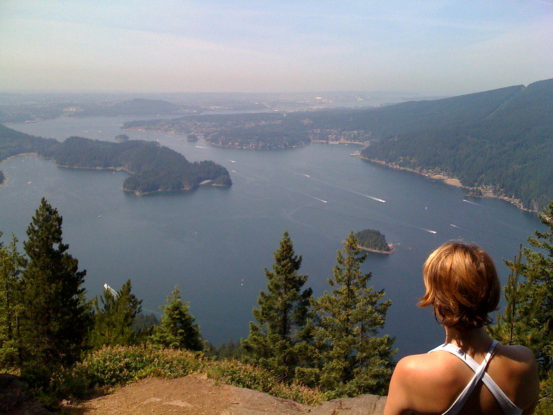
Hiking Diez Vistas. Hello Vancouver! Photo by Taz on Flickr.
Looking for a longer hike near Vancouver with spectacular views and swimming beaches? The 15 km Sendero Diez Vistas Trail, named for its ten views of Indian Arm and surrounding areas, is only an hour drive from Vancouver. Hikers can begin the loop on the Buntzen Lake Trail from the north end of the Buntzen Lake parking lot. This trail leads to the south end of the lake where a floating bridge crosses over a marshy area to the Diez Vistas Trail. Meandering uphill through forest on switchbacks, the trail reaches the ridge above, where the views begin.
The first view is of Sasamat Lake and Belcarra Regional Park, with Burnaby and Vancouver in the distance. The second overlooks Buntzen Lake and the beach area below. The third is the widest and most spectacular view, showcasing North Vancouver, Deep Cove, Indian Arm, Burrard Inlet, Burnaby, downtown Vancouver, Vancouver Island, and Sasamat Lake. Towering high above Indian Arm, the three peaks of Mount Seymour are also visible.
From here, the trail continues along the ridge with views of Indian Arm, although some viewpoints have grown over with foliage. The hike weaves through forested areas and gradually descends back downhill to the north end of Buntzen Lake, rejoining the Buntzen Lake Trail. A suspension bridge crosses the north section of the lake to a quiet spot for swimming at North Beach. The trail continues along the eastern shore of the lake, crossing small streams and offering occasional glimpses of the lake and surrounding mountains. The popular South Beach, just before the parking lot where the hike ends, offers another great place to cool off with a swim.
Race the River 2022 sponsors:
